Viking Navigation: How Norse Sailors Crossed Open Oceans Without a Compass
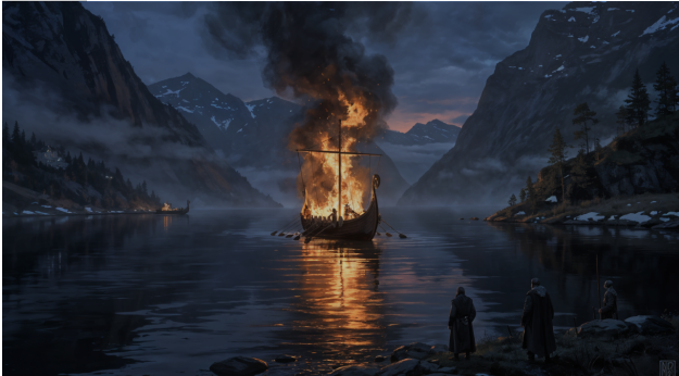
Somewhere around 985 AD, a Norse mariner named Bjarni Herjólfsson drifted off course in thick fog while sailing from Iceland to Greenland. He never found his father’s farm that season — but he did spot the forested coastline of North America, becoming the first known European to lay eyes on the New World. He did it all without a magnetic compass, without a sextant, and without a single nautical chart. The story of Bjarni is just one thread in the remarkable tapestry of Viking maritime history, a tradition that enabled Scandinavian seafarers to dominate the North Atlantic for over three centuries. Viking navigation remains one of the most impressive achievements of the medieval world — a sophisticated system built on keen observation, oral tradition, and ingenious tools that modern science is only now beginning to fully understand.
From the fjords of Norway to the shores of Newfoundland, Norse sailors covered distances that would challenge modern yachtsmen. They crossed the open Atlantic — roughly 1,600 nautical miles from Norway to Iceland, and another 900 from Iceland to Greenland — in open-decked wooden ships with square sails. How they managed this without the instruments that later European navigators considered indispensable has puzzled historians for generations. But the archaeological record, saga literature, and recent experimental research have begun to reveal answers that are far more sophisticated than educated guesswork.
The Sun and the Sunstone: Finding Light in Overcast Skies
The sun was the Viking navigator’s primary reference point. In the high latitudes of Scandinavia and the North Atlantic, the sun’s arc across the sky shifts dramatically with the seasons, and experienced Norse sailors could estimate their latitude by observing the sun’s noon height above the horizon. This method, sometimes called “latitude sailing,” involved sailing north or south until the sun reached the correct noon altitude for the destination, then turning east or west and holding that latitude until land appeared.
But the North Atlantic is not known for its clear skies. Fog, low cloud, and endless overcast days are the norm, particularly in the waters between Iceland and Greenland. This is where the legendary sunstone — the sólarsteinn mentioned in Icelandic sagas — enters the picture. Medieval texts including Rauðúlfs þáttr describe a glowing stone that King Olaf used to locate the sun behind clouds. For centuries, scholars dismissed this as myth.
They were wrong. In 2011, a team led by Guy Ropars at the University of Rennes demonstrated that Iceland spar — a transparent form of calcite abundant in Scandinavia — can detect the polarization of sunlight even through heavy cloud cover. When you rotate a piece of Iceland spar against the sky, the crystal produces a double image of any light source. The two images reach equal brightness at a specific orientation that reveals the sun’s position to within a few degrees. Experimental trials showed that navigators using this method could determine the sun’s bearing with remarkable precision, even when the sky appeared uniformly grey.
Further confirmation came in 2013 when a calcite crystal was recovered from the wreck of an Elizabethan warship that sank near Alderney in the English Channel in 1592. Though the ship was centuries younger than the Viking Age, the discovery proved that sunstone-style navigation crystals were carried aboard real vessels, not just mentioned in folklore. The crystal was found near other navigational instruments, strongly suggesting it was part of the ship’s practical toolkit.
Stars, Whales, and Wave Patterns: Reading the Ocean Like a Book
The sunstone was only one tool in a much larger navigational system. At night, Norse sailors looked to the stars. Polaris — the North Star — sits almost directly above the North Pole and barely moves through the night, making it an obvious fixed reference. But Viking navigators also tracked the rising and setting positions of other stars and constellations, using their positions relative to the horizon to gauge direction and time. The Old Norse term for the constellation we call the Great Bear was “Karlsvagn” — Karl’s Wagon — and it served as a reliable circumpolar guide through the long northern nights.
Beyond the sky, the sea itself was full of information. Experienced Norse mariners could read wave patterns the way a modern pilot reads instrument panels. Ocean swells in the North Atlantic tend to come from consistent prevailing directions, and a skilled navigator could detect when the ship’s heading shifted by feeling changes in the wave rhythm beneath the hull. Reflected waves bouncing off distant coastlines created interference patterns that signalled land long before it was visible. Modern Pacific Islander navigators use an almost identical technique, which lends credibility to the idea that Norse sailors did the same.
Wildlife offered another layer of data. Norse sailors paid close attention to seabirds. Species like the fulmar and the gannet have known foraging ranges from shore, so spotting them indicated proximity to land. The Landnámabók — Iceland’s medieval Book of Settlements — records that early Norse voyagers carried ravens aboard ship and released them at sea. If the bird flew off in a direction and did not return, the sailors followed it toward land. This tradition gave the legendary explorer Flóki Vilgerðarson his nickname: Hrafna-Flóki, Raven-Flóki. Whales and seals also congregated near productive coastal waters, and their presence or absence gave mariners useful clues about position.
The Bearing Dial and the Shadow Stick
In 1948, archaeologists excavating a Benedictine convent at Uunartoq in southern Greenland uncovered a fragmentary wooden disc that would reshape our understanding of Viking navigation. The Uunartoq disc, as it came to be known, is roughly 70 millimetres in diameter and features a series of scratched lines radiating from its centre. Researchers believe it is half of a bearing dial — a tool that could determine true north using the shadow cast by a central gnomon, or vertical pin.
The principle is elegant. A pin is placed upright in the centre of the disc. As the sun crosses the sky, the tip of the pin’s shadow traces a curve — a hyperbola whose shape depends on the date and the latitude. If the navigator scratched the correct curve for the current date onto the disc, the shadow’s position along that line would indicate due north at any time of day, not just at noon. In 2013, researchers at Eötvös Loránd University in Budapest built functional replicas and demonstrated that the device could determine north with an accuracy of roughly four degrees — more than adequate for open-ocean crossings.
A simpler version of this idea — the shadow stick or bearing board — may have been even more common. A stick placed vertically on the ship’s railing would cast a shadow whose length at local noon indicated latitude directly. Combined with a notched measuring board, a navigator could compare the noon shadow length to a known reference for his destination port. When the shadows matched, he was on the right latitude. This method required no literacy, no mathematics, and no fragile instruments — just a stick, the sun, and generations of accumulated knowledge.
Landmark Navigation and Oral Sailing Directions
For all their open-ocean skill, Norse sailors preferred coastal routes whenever possible. Sailing directions passed down through oral tradition described sequences of landmarks — mountain profiles, glacier positions, distinctive rock formations, and river mouths — that guided mariners along well-travelled routes. The Hauksbók, a 14th-century Icelandic manuscript, preserves one such set of directions for the voyage from Norway to Greenland: sail west from Bergen, pass north of Shetland close enough to see it in clear weather, pass south of the Faroes at such a distance that the sea appears halfway up the mountains, then steer south of Iceland so that you can sight birds and whales from it.
These instructions are remarkably precise. They describe a great-circle route that modern navigators would recognize as nearly optimal, and they encode latitude information through visual benchmarks. The instruction to pass the Faroes “so the sea appears halfway up the mountains” is effectively a way of specifying the exact distance offshore — and therefore the exact latitude — without numbers. It is navigation by accumulated experience, packaged in language any sailor could remember and repeat.
Recent Discoveries and Modern Validation
Archaeological finds in recent decades have transformed Viking navigation from a subject of speculation into one of hard evidence. Beyond the Uunartoq disc and the Alderney sunstone, researchers have identified possible navigation tools at sites across Scandinavia. In 2018, Hungarian and Swedish scientists published research demonstrating that the sunstone method works even during twilight conditions, extending its usefulness to the long dusk hours of Arctic summers when the sun barely dips below the horizon.
Computer simulations published in Royal Society Open Science in 2018 tested thousands of virtual Viking voyages between Norway and Greenland using sunstone navigation at various intervals. The results showed that checking the sun’s position every three hours gave a success rate above 90 percent, even in persistently cloudy conditions. Less frequent checks reduced accuracy, but even readings taken every six hours produced viable crossings — suggesting that the sunstone was a practical tool, not just an occasional curiosity.
Experimental archaeology has also contributed. In 1893, a replica Viking ship called the Viking sailed from Bergen to Newfoundland in 28 days. More recently, the Draken Harald Hårfagre — the largest Viking ship reconstruction ever built — crossed the North Atlantic in 2016, using both modern and traditional techniques. Her crew reported that traditional methods of wave reading and star observation remained surprisingly effective, even to sailors trained primarily on GPS and electronic charts.
A Legacy Written in Salt Water
The genius of Viking navigation lay not in any single breakthrough, but in the combination of multiple overlapping systems. Sunstones for cloudy skies, stars for clear nights, wave patterns for open ocean, wildlife for approaching land, shadow sticks for latitude, and oral directions for established routes — each method compensated for the weaknesses of the others. It was a redundant, resilient system born from centuries of trial and error in some of the most dangerous waters on Earth.
When Columbus crossed the Atlantic in 1492, he carried a magnetic compass, an astrolabe, and detailed charts. The Norse had reached the same continent 500 years earlier with none of those instruments. They did it by watching the sky, feeling the sea, and trusting a body of knowledge that their grandfathers had built one voyage at a time. In an age of satellite navigation and digital charts, that achievement deserves more than admiration — it demands respect.
The methods of Viking navigation were not primitive alternatives to proper instruments. They were the instruments — refined over generations, tested against the unforgiving North Atlantic, and proven by the simple fact that the Norse reached every corner of the known world and several corners no European had known existed. Every longship that beached on a foreign shore was proof that the system worked. And every archaeological find that confirms these techniques is a reminder that our ancestors were far cleverer than we sometimes give them credit for.